An Easterner’s Sampler of the West
Our goal – to cross the large expanse of the Great Plains separating the east from the west, and to explore the Colorado Plateau region of New Mexico, Arizona, Utah, and Colorado.
The first four days we bobbed and weaved through the chaotic
weather systems that were hammering the central sections of the U.S. – flooding
to the north, severe thunderstorms, hail and tornados just about everywhere
else. We ad-libbed our route (to our advantage, thankfully), and the skies cleared
as we entered
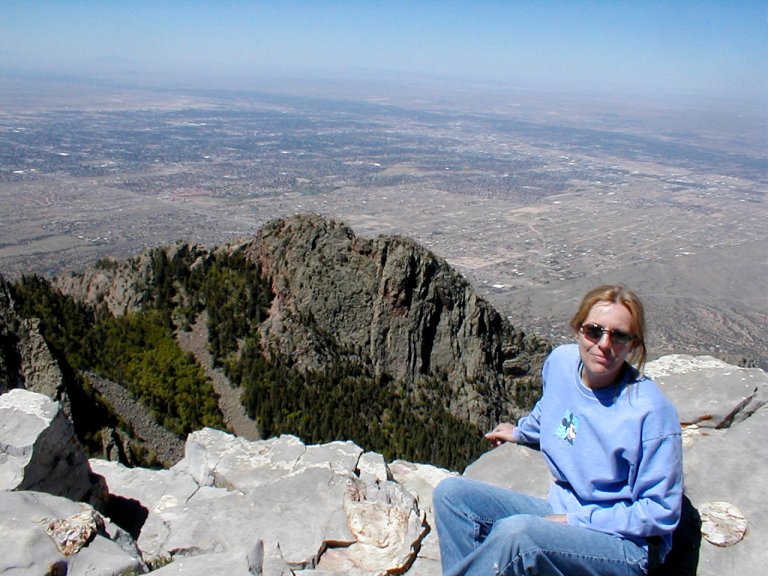
Just east of
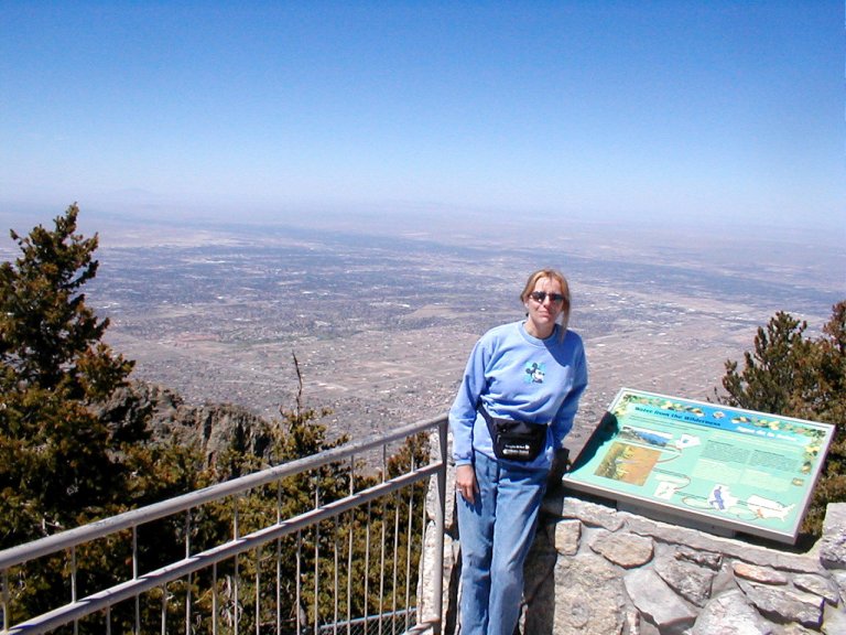
It was a clear day, and the
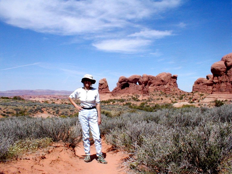
Further along the Turquoise Trail there’s an odd town known
as
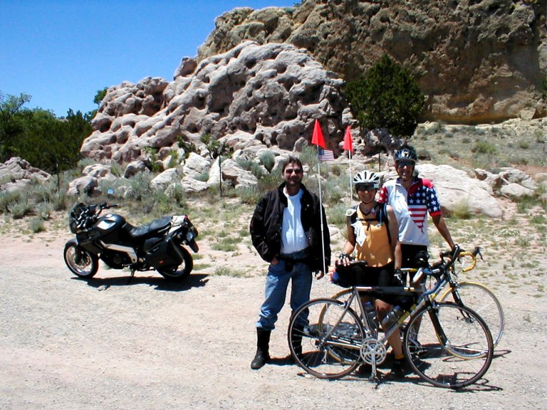
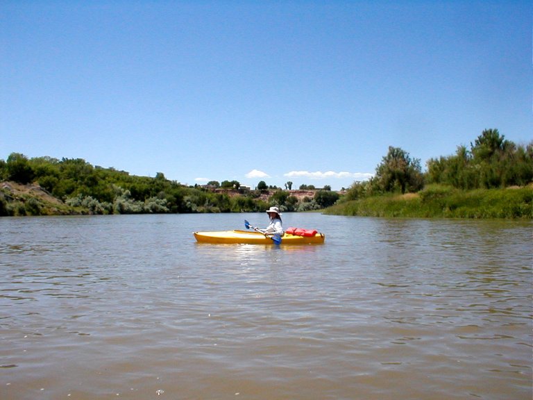
Other sights in the Albuquerque area are the “Old Town” shopping district, where we failed to find a geegaw that we just couldn’t do without; the Rio Grande Nature Center, which features pleasant hikes along the famous waterway; and Petroglyph National Monument, featuring stone etchings of American Indians possibly as old as 3,000 years.
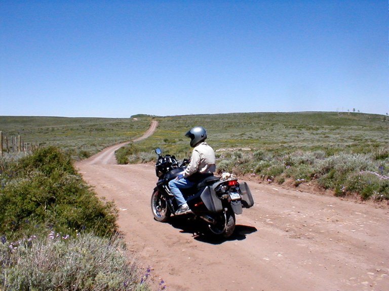
Continuing west, we take a side trip into
I have a
preconceived notion of the concept of “desert” – I picture a flat, desolate
expanse of dry bleakness, with the occasional cactus or scrub brush. That does not
aptly describe the
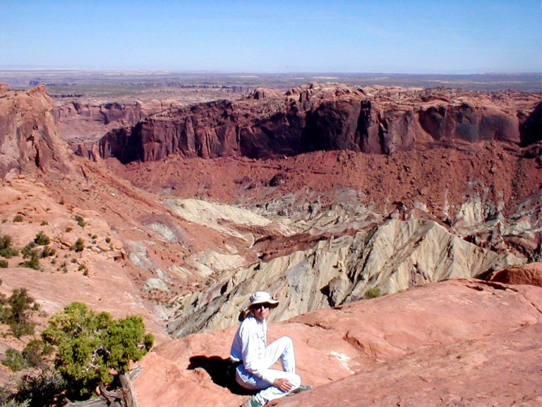
The approach drops abruptly away from a rim, and the landscape below is an amazing variety of buttes and spires, knobs and flats – any variety of muted colors. And 'tee-pees'!
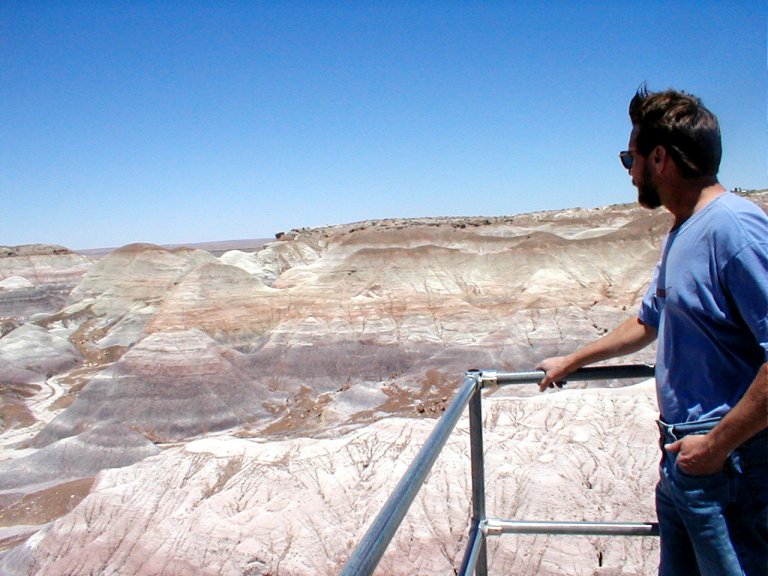
A favorite spot was the Blue Mesa turnout – a walkway descends through that most remarkable landscape. Here we began to see petrified trees, and those continue in the further overlooks. It’s not a standing forest of petrified stumps, as I had naively expected, but rather a jumbled pattern of the fallen trees revealed as the burying landscape erodes from around them.
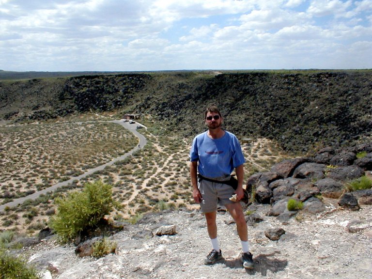
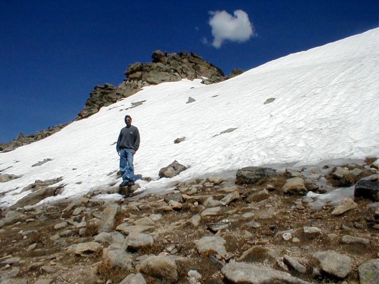
The next morning we turn north, and take a side trip through Wupatki/Sunset Crater Volcano National Monuments. It’s a strange place – jagged lava flows, blankets of cinders covering the landscape, vegetative growth appearing most improbable in the coarse black soil. In 1064 the settlers of the area were displaced by volcanic mayhem – that being the most recent eruption in the Colorado Plateau region. All morning we had been observing an inordinate number of “toy hauler” RV’s, similar to ours, which is very unusual. Occasionally we’d see an open trailer on which was tied down a dune buggy, or sand rail, or whatever the proper term is. When we saw from a distance a number of clouds of black dust careening down the steep cinder slopes of the terrain we were driving through, we deduced that we must be witnessing a rally or competition of some type.
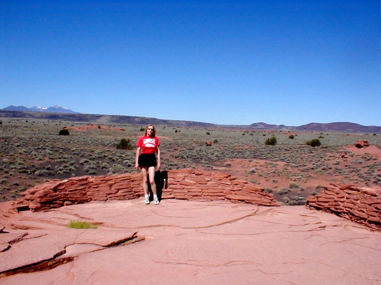
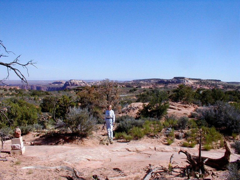
Further on we walked among the ancient Wuptaki ruins, elegant structures of stone and mud that are built upon and around the stone outcroppings on which they stand. The thin layer of ash deposited by Sunset Volcano had, for a time, turned this region into a productive agricultural center. When the ash was gone, so departed the population.
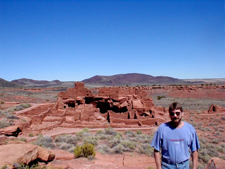
One ruin in particular I found fascinating. We climbed to the second story of the structure and gazed, from our high overlook, across the rich red landscape—dotted with green sage and the occasional desert-flower. In the distance the slopes of a snow-capped mountain range stood tall under a clear blue sky. Sue and I stood there alone, not another creature, human or otherwise, in evidence. I found it difficult to imagine living in that remote desert environment, but my perceptions would differ from those who walked the planet nearly a thousand years ago.
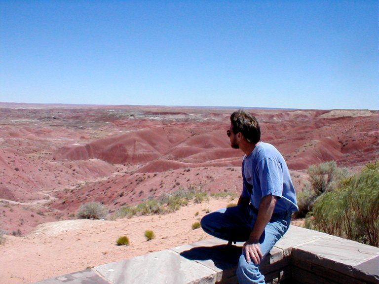
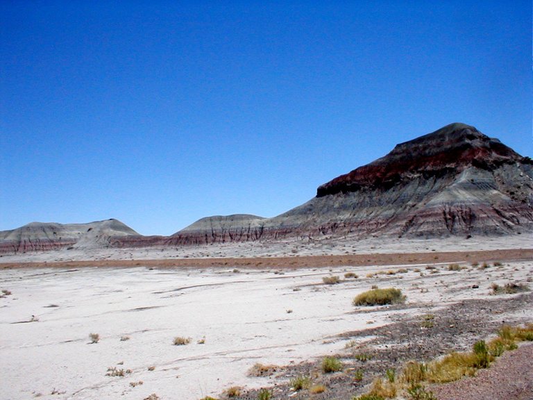
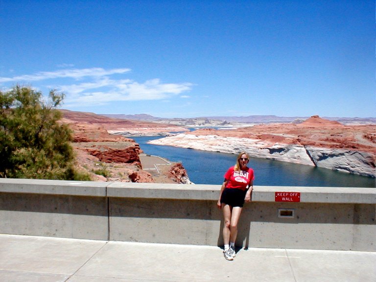
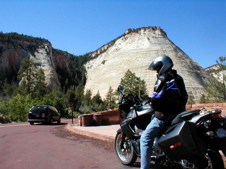
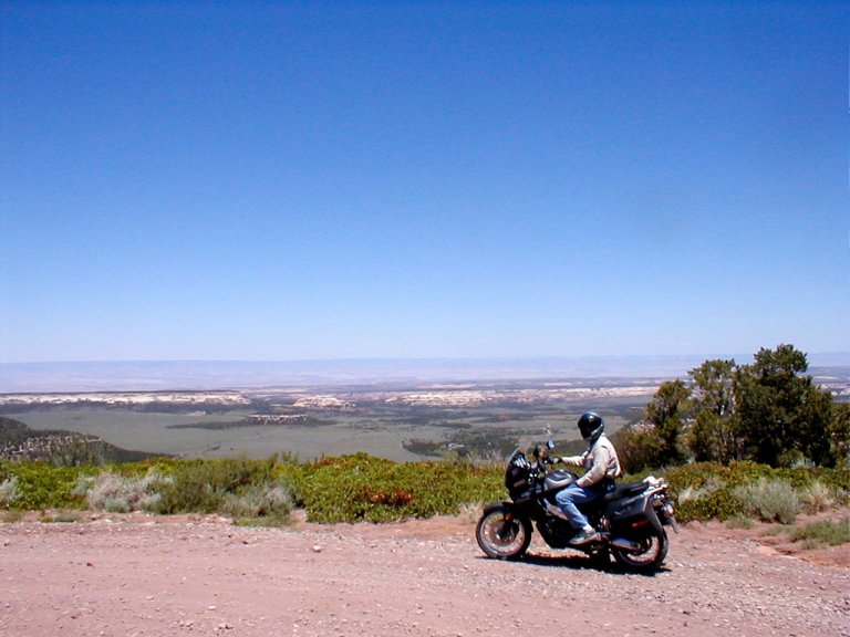
Continuing north on Highway 89, I wondered why this stretch was not an official Scenic Byway. Another cliche, “otherworldly” came to mind. The strange combinations of colors and shapes, the result of selective erosion revealing the layers of sedimentary deposits of those formations that remain standing, were awesome. The nuances of color gave textures to the forms – some of the coarse mounds or slopes almost appeared to have a velvety texture to them – by virtue of the subtly changing tones of color. Approaching Page, Arizona, the road started a serious climb – the mighty turbo-diesel had to work hard to pull the heavy 5th wheel up that long, long slope. Near the top we looked out over the flatlands far below us – those “flats” being rent by a jagged canyon that plummeted yet another dramatic level. Amazing!
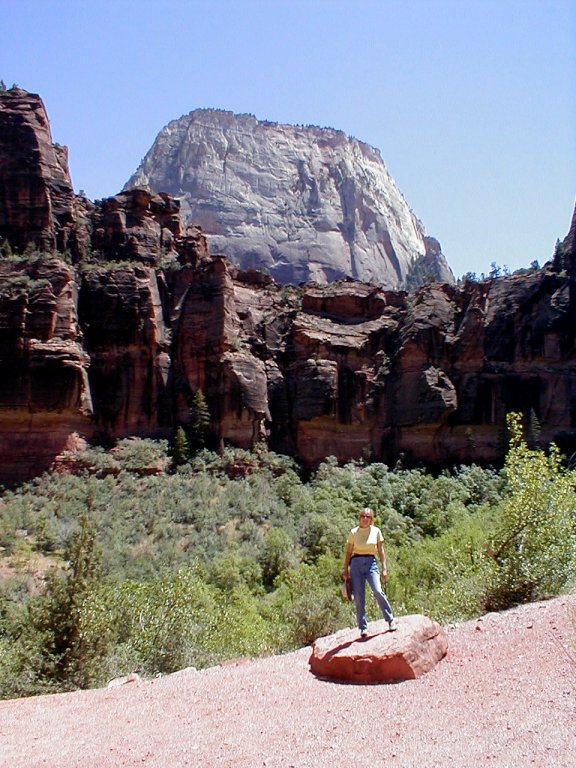
We crossed the 710’ bridge beside the
In
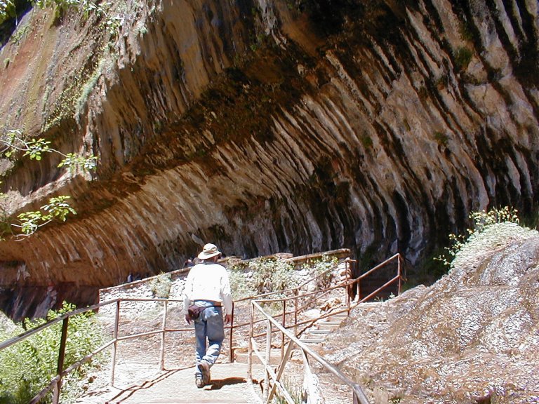
The long dark
passage has viewports cut through at intervals,
providing brief glimpses of the colorful rock-scapes of
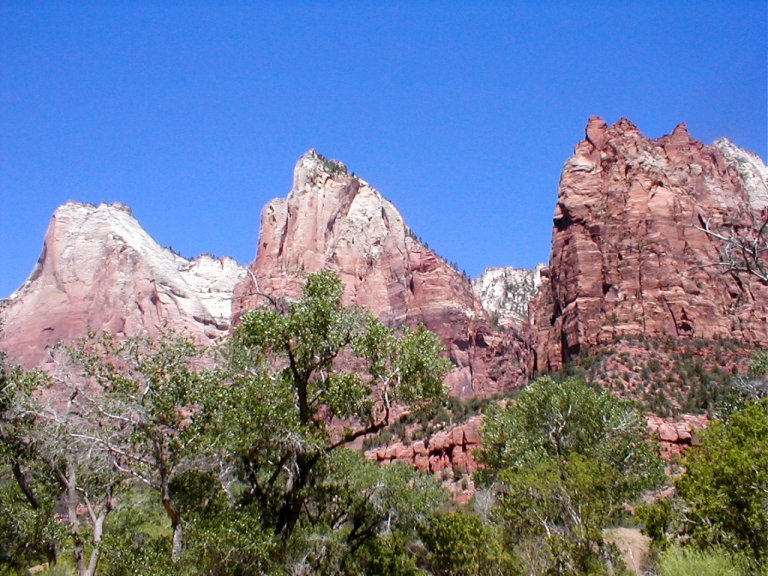
Touring by shuttle bus, we did a
number of short hikes, including one that progressed up the valley floor to the
spot known as “the narrows”, where the high cliff sides close in tight over the
Next up:
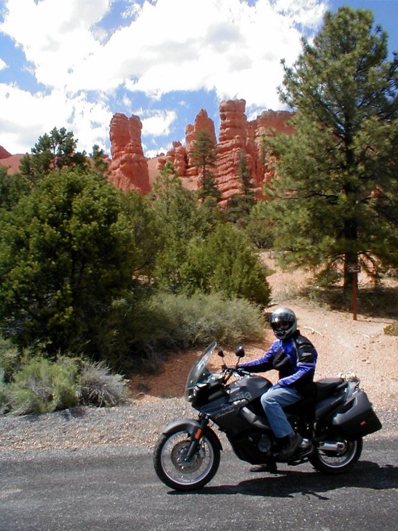
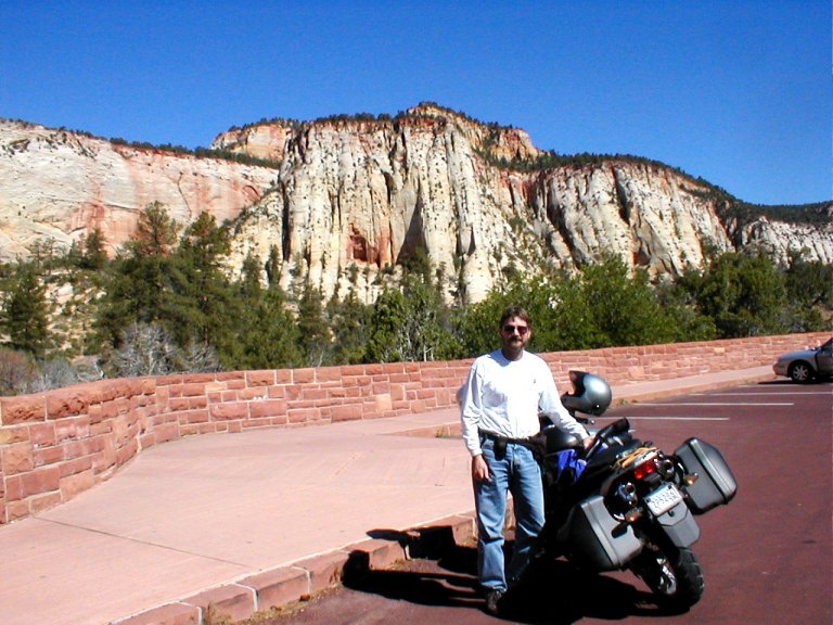
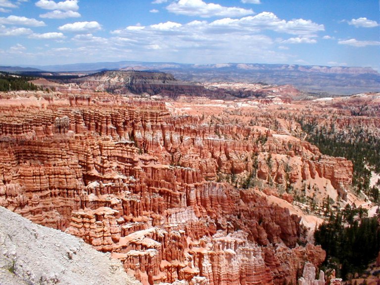
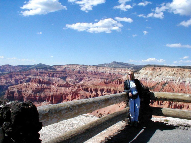
Considerably higher in altitude than
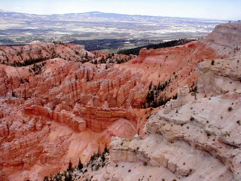
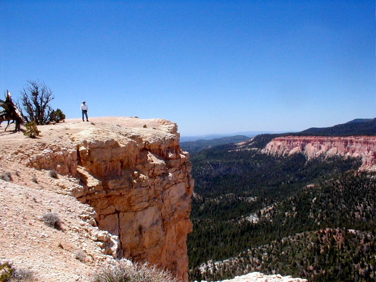
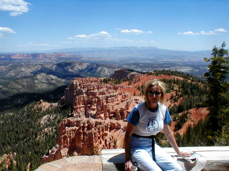
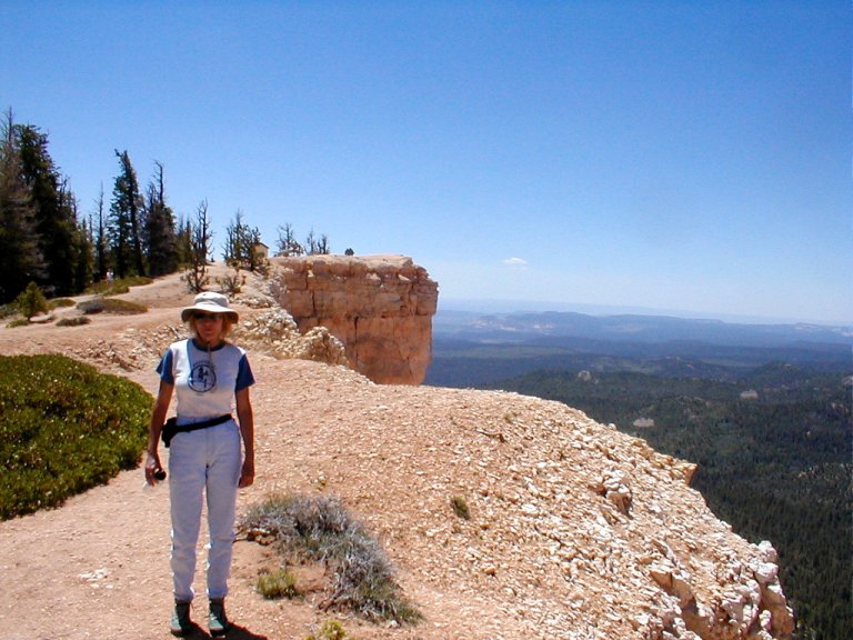
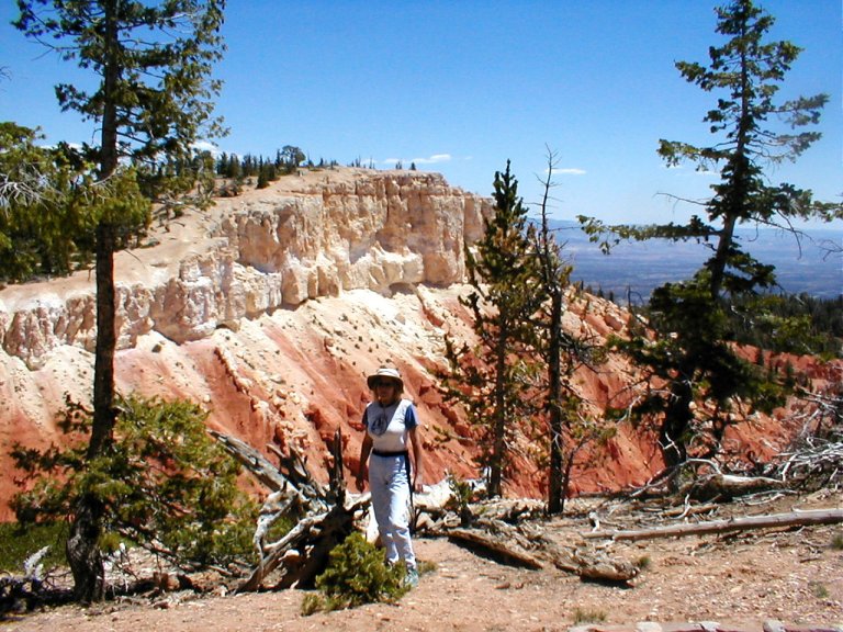
HooDoo!
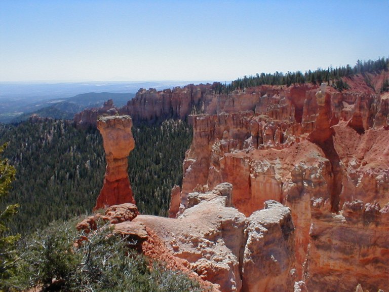
I love that word, and I love the stone spires that it describes. Created via erosion over a period of, uh… I’m not sure how many millennia, hoodoos are improbable pillars of stone jutting skyward in any number of unlikely shapes. At Inspiration Point Overlook, one of the more amazing spots, the hoodoos are arrayed in a seemingly ordered pattern, phalanx upon phalanx standing proud and forbidding. It reminded me a little of a forgotten sci-fi story - where an army of aliens stood immobile for eternity, forever awaiting the signal that never comes.
On the return trip we took a side route to
Continuing our trek, we turned east on I-70 and continued to
pass through diverse regions that are both strange and wonderful. Climbing and
descending through micro-regions, each seems to bear little resemblance to
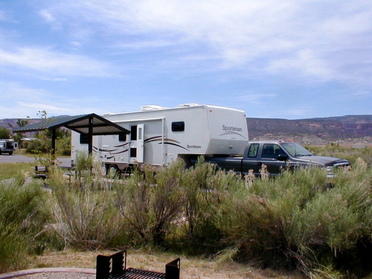
those just passed by and those yet to come. We set up camp in
In our campsite just south of
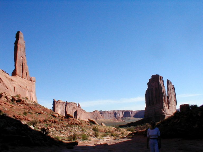
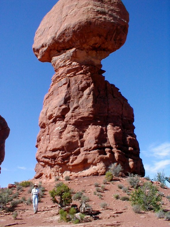
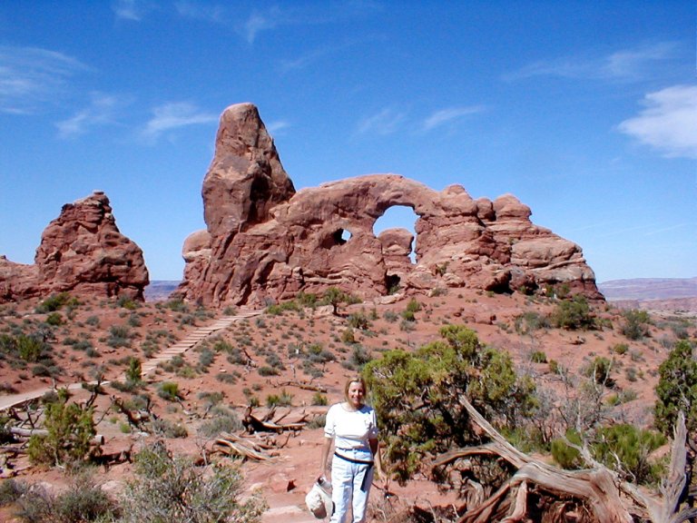
It is my understanding that the hundreds of arches that exist throughout the park at one time stood as solid slabs of stone. Former arches have collapsed, as will the existing arches eventually fall, and new arches will come into being from the erosion of the massive slabs that now stand. I’ll not embarrass myself (or amuse you) by attempting a rigorous explanation of these landforms, I’ll just tell you that we spent many enjoyable hours riding and hiking through these colorful, astonishing stone formations that towered over us. We started with a two mile hike up and back the trail named Park Avenue (a bit misleading, I’d say),
and came to the end in Devils Garden.
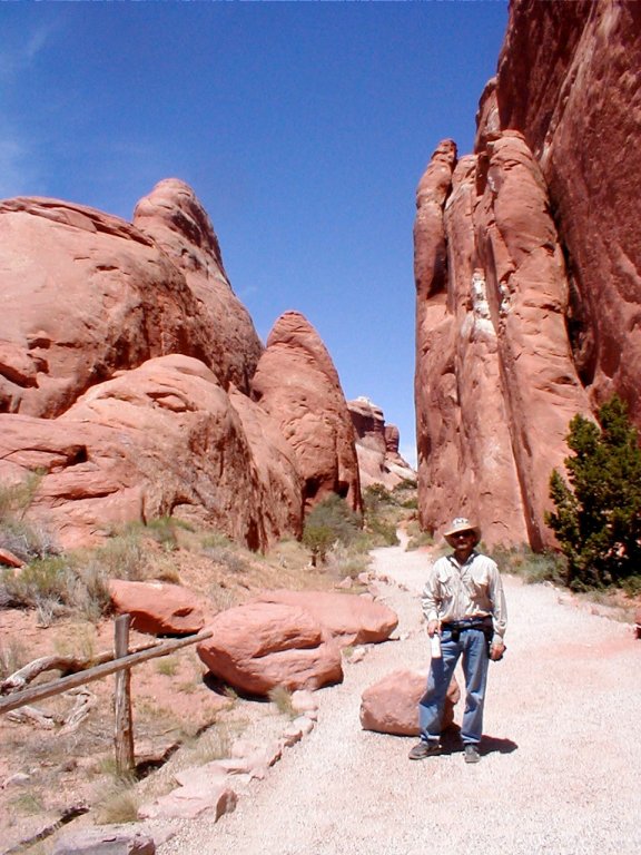
I could not help but wonder, while gazing upon all those precarious formations, if that one looming over us just now might choose this very moment to succumb to gravity and come crashing down.
Whew! Not to worry, we came through it in one piece. As the sun climbed past its apex and we fled the park for our air conditioned refuge, the temperature had again exceeded 100 degrees.
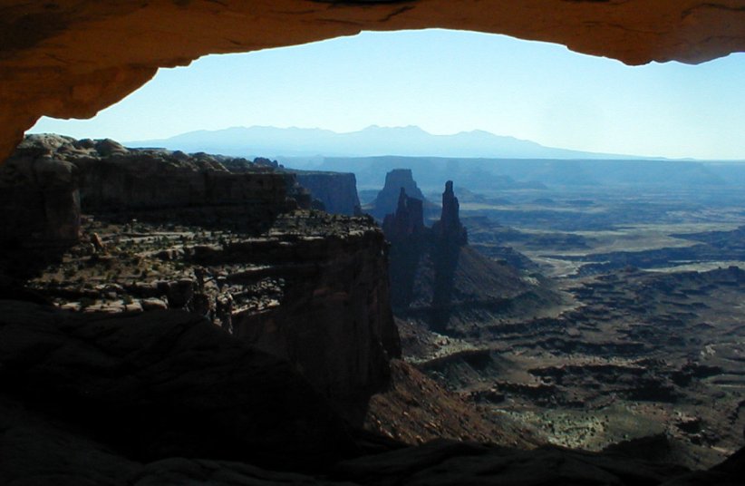
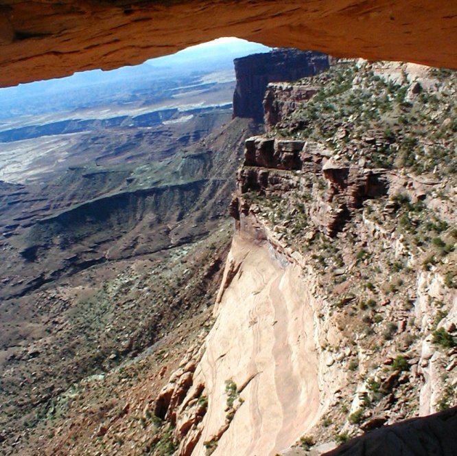
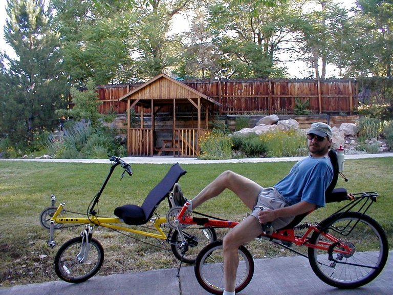
Another morning ride finds us off toward
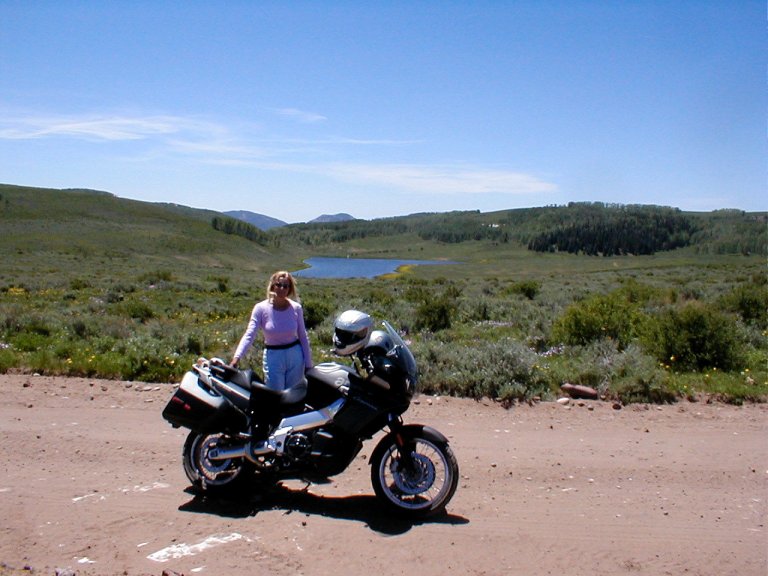
Island in the Sky is bracketed by the Green and
My favorite stop in
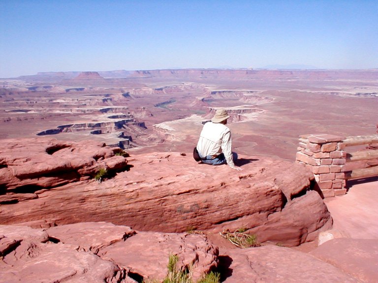
An interesting side-note here is that we continued to encounter more foreign tourists in the National Parks than we did Americans. The truth is – I believe the Europeans have a healthier perspective with regard to leisure time. They seem to have more of it!
We knew our drive from
We’d set up camp in
We had known that there was one good tour in the area, the
Just a short distance from our campground was the western
entrance to
We’re still in the realm of the
Colorado Plateau, which includes the Parks we’d visited in
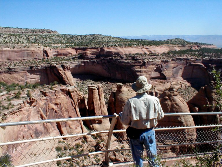
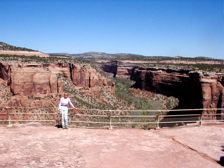
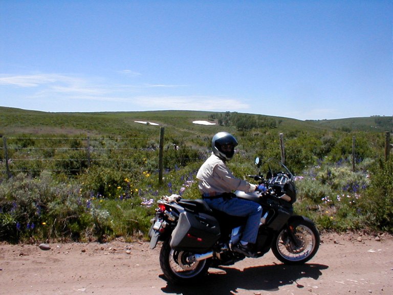
Toward the end of this ride we stumbled upon an unexpected highlight. On a whim I took a turn toward what was labeled “Glade Park Store”, some 5 miles away. The landscape changed to more level, less dramatic ranchland-type territory, and it turned out our destination had been literally labeled – it was a country store at a rural crossroads, having made its place there nearly 100 years prior. We noticed a small billboard map on the otherwise vacant opposite corner, and we decided to follow the route described there.
We began to climb to the south, first moderately on a nicely
paved road, and then more steeply on a dirt/gravel/rock road. We passed the Mud
Springs Recreation Area (what looked to me a backcountry campground), and
continued south to the Haypress camping area, now in
the
I believe this might have been one of my very favorite rides;
we seemed to have the entire world to ourselves, wide vistas and nary another
soul about. I later learned that the
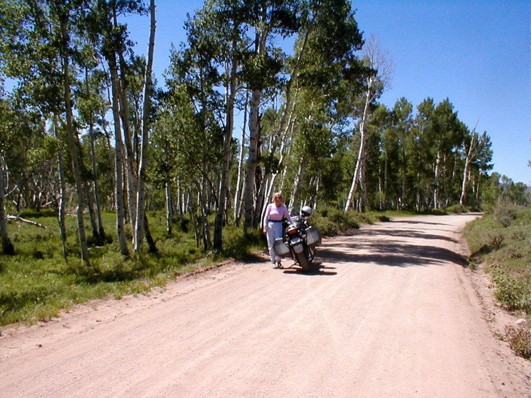
Turning back north from the southern apex, we marveled at the change in landscape. As we gradually descended from the Aspen forests, the landscape cleared to vast rolling countryside – beautiful greens interspersed with the blue-green sage look of the west, all sprinkled generously with yellows, purples, reds, and blues of the blankets of wildflowers spreading near and far. After spending many days flirting with the century-mark, it seemed odd to be probably only 20-some straight-line miles away from the heat, but now riding in 70ish temperatures with large pockets of snow still unmelted along the dirt roadway.
Finally we began a serious descent, and as we came down the
steep slopes we looked out across the flats below – softly rolling in verdant
green/blue. We came back out onto fairly level ground—back on fast rolling
pavement running between softly contoured rock formations standing tall all
around—and I marveled at the fact that we were still gradually descending
toward the upper plateau of the Colorado
National Monument. We finally descended steeply through switchbacks toward
I was leery about our route from western to central
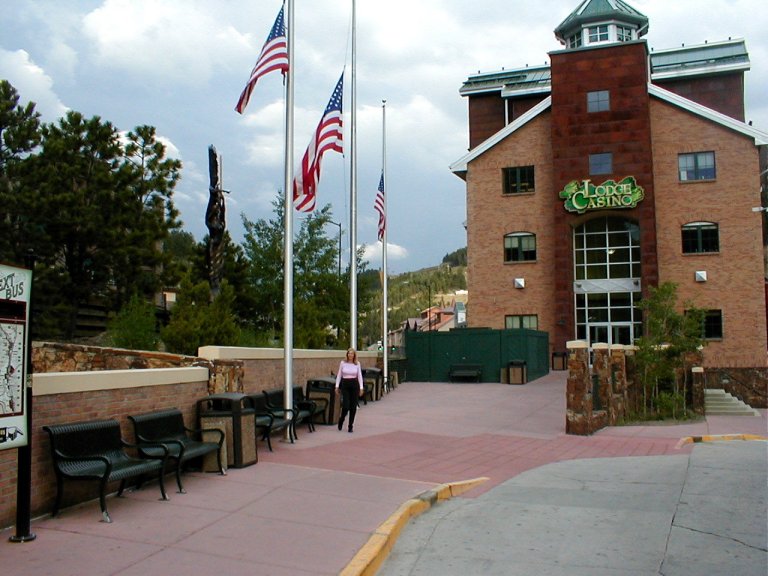
We next set up camp in Central City. I remember coming through Central City as a child – at that time what I remember is a tourist town that banked on its gold mining history. I was picturing a restored ghost town theme.
Well.
The town of
During the evening we had some pretty good thunderstorms,
but nothing like what was happening in
Based on that, and the forecast of further violent thunderstorms, we decided, even though the AM dawned bright and clear, to take the truck rather than the bike on our trip through Rocky Mountain National Park (RMNP). I kicked myself regularly on that 6 hour trip, especially when I watched other riders pass blithely by in the early hours under cold, but spectacularly clear, skies. My opinion began to change later as the dark clouds closed over and the wind picked up, and big raindrops began to fall. Then we watched, from the heated comfort of the F250, bikers riding in cold rain, and I felt absolved. As I later sat to write these words on my laptop, the hail was drumming on the roof of our RV.
Passing through
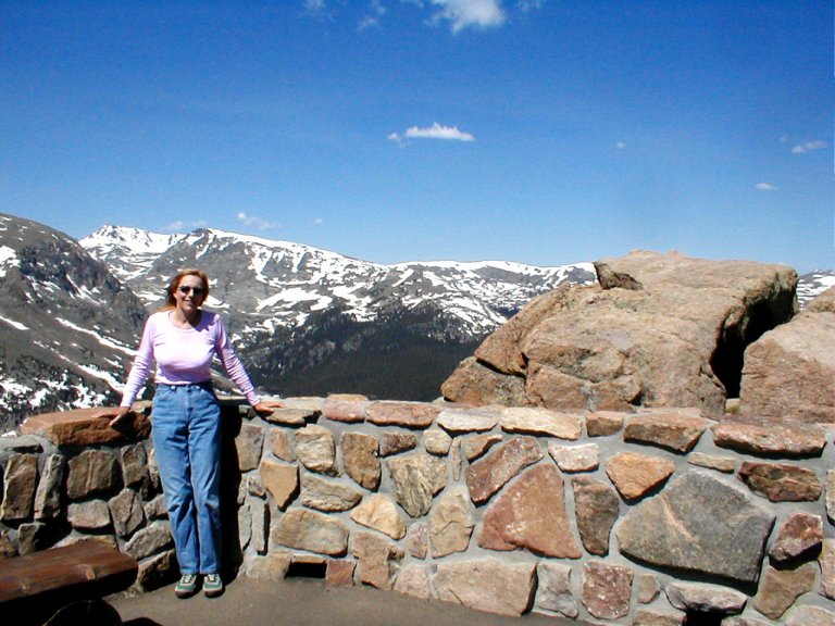
RMNP is a locale to make you consider your place in the world, a premier alpine roadway.
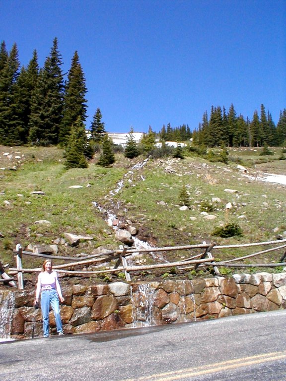
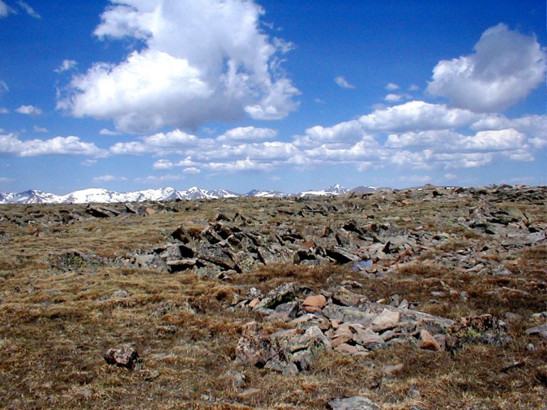
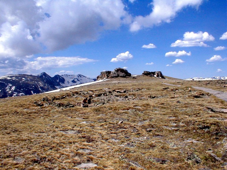
Closed during the winter season, with tall poles lining the roadway so they’d stick up above the snowpack and show the snowplow drivers where the road was (and wasn’t), the roadway had been closed the prior week because of a late snowfall. Open again now, we climbed through various stages of forest growth, from pine and juniper to fir and spruce, and then we came above the treeline into an alpine region of tundra growth. We’d stop to look upon snowmelt waterfalls tumbling down the slopes, and narrow creeks snaking across the relatively flat surfaces of valley floors.
We hiked up designated paths (tundra is easily damaged and recovers very slowly) to look out across the great heights and far distances (we hiked slowly, because we’re from the southeast, and we’re now hiking at altitudes well over two miles high). It’s awe-inspiring, and self-deprecating. I loved it.
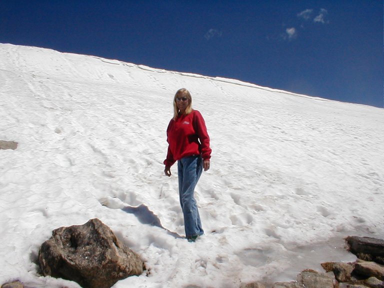
The next AM we layered with thermal clothing in anticipation
of scaling nearby
We came to a spot where the tundra is dotted with small, shallow bodies of clear water. There is a modest sized lake at the base of a steep slope – it is mostly frozen, but draining clear water at the lower end. The water ripples lively with the brisk surface winds. We watch as a small deer bounds across the completely open landscape.
The Ranger Station had warned us about some road damage ahead, and they weren’t kidding. At one point the tarmac began to undulate like a great serpent – heaving, dipping, and twisting with abandon. Even on the long-suspension Caponord I had to proceed slowly, if I’d been piloting a low slung cruiser I’d have been grinding bits and pieces on the asphalt and slamming short-travel suspension pieces to their stops.
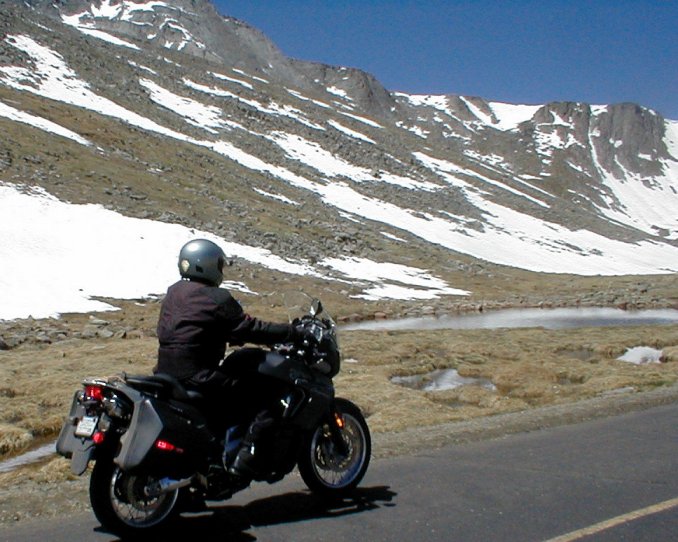
As the climb became
even steeper and the road narrower, I must admit to some trepidation. There
were lots of deep grooves carved in the pavement around the challenging 180
degree switchbacks – probably riven by RV-type
vehicles that should not have been attempting the route. By the time we could
actually see the summit, marked by a domed
But that last section was the most extreme in terms of steep
switchbacks. If you look at that last segment on the map, it looks like
somebody just squiggled their pen back and forth in a
tight pattern. To be honest, the last section is not that bad … so long as you
don’t falter. Precise throttle and brake control are good. Though traffic was
light, as I approached the switchbacks I’d try to look beyond to see if a
vehicle was coming the other way. If so, I’d stop before the curve and let it
pass through first. A couple of large passenger vans traveling together used up
most of the roadway around one such turn – I’m glad I wasn’t trying to share
the pavement at that point.
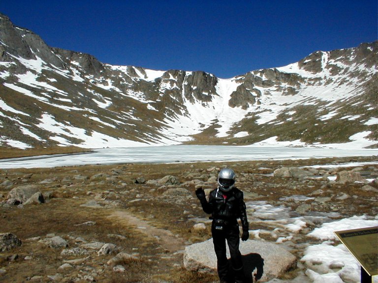
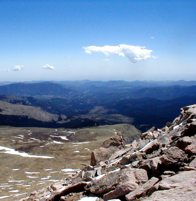
There is a structure at the apex parking area, built in 1940, that was once the highest (elevation) snack bar in the nation. It’s now an open-air viewing platform. Its elegant arched stone walls stood out against the crystal blue sky. We clambered –slowly- around the Crest House structure. Now working at 14,130 feet, this low-altitude southerner didn’t want to come up short of wind and impair his ability to pilot the bike down the long descent.
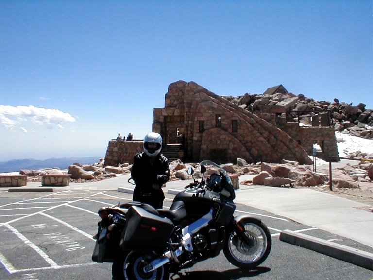
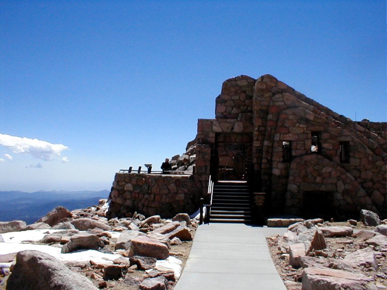
I believe that I mentioned it was windy on
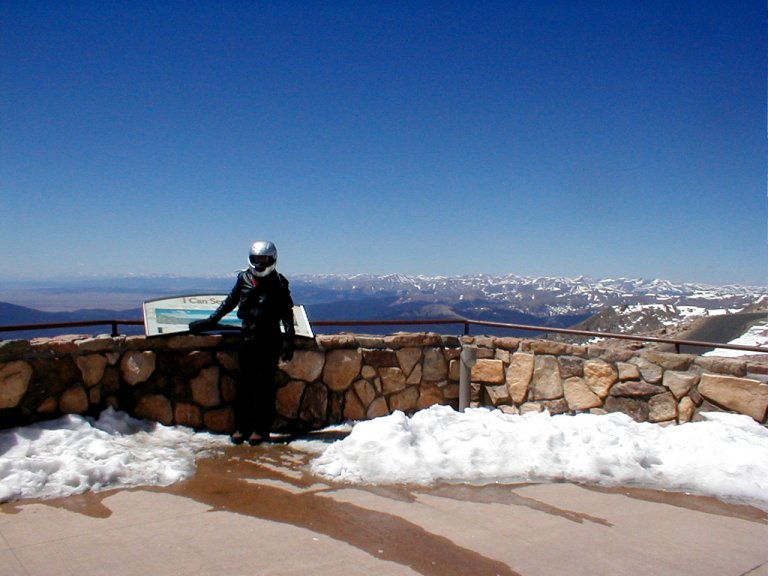
I’d watched in amazement while ascending
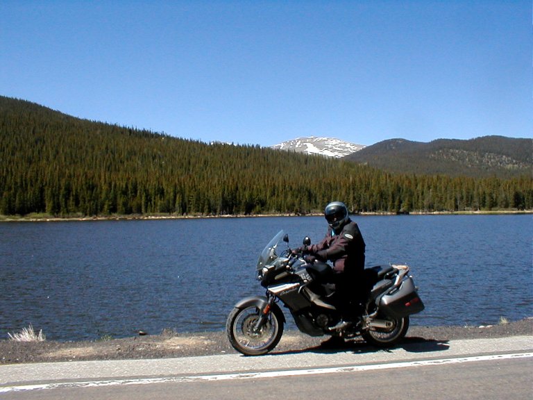
Back down out of the high mountains (to a mere 7,000 or so feet), the temperature was back up to the low 70’s. We stripped some of our layers and picked a couple of canyon routes to finish off the day’s ride. The wind picked up seriously – it seems to do such at its whim in these mountain environs. Sue doesn’t much care for the high winds on a motorbike, can’t say that I do either.
We finished the tourist portion of our trip the following
day with some touring of my childhood hometown,
We had a second tornado scare as we returned through